Imagico.de
Geovisualizations
by Christoph Hormann
Sentinel-2 mosaic of the Balleny Islands
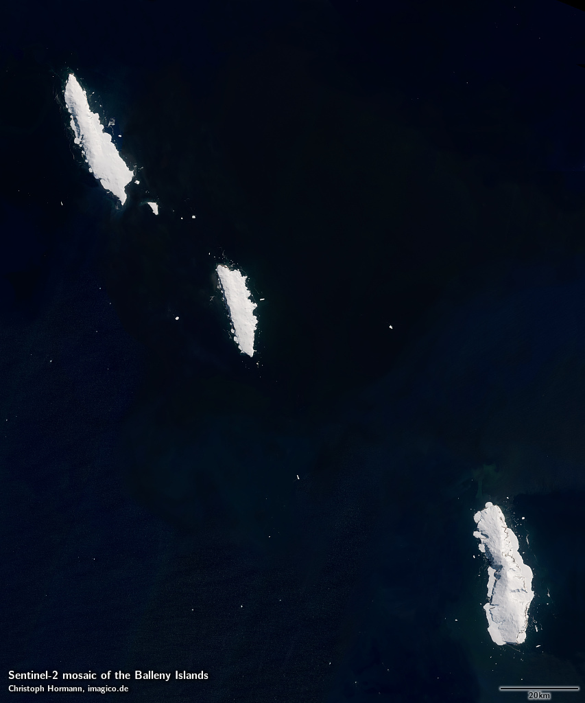
This Sentinel-2 mosaic of the Balleny Islands gives a realistic up-to-date visual color impression of the area as it appears during summer with a minimum of sea ice and snow. Most source data is from between December and March.
This Sentinel-2 mosaic can be considered a higher resolution supplement to the Green Marble and similarly it represents the surface color with compensation for the effects of the atmosphere.
Source data is mostly Copernicus Sentinel-2 imagery from 2016 to 2018 with smaller parts based on Landsat 8 imagery from 2013 to 2018.
Key properties
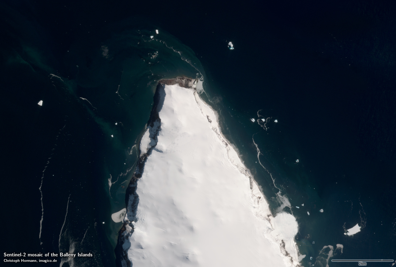
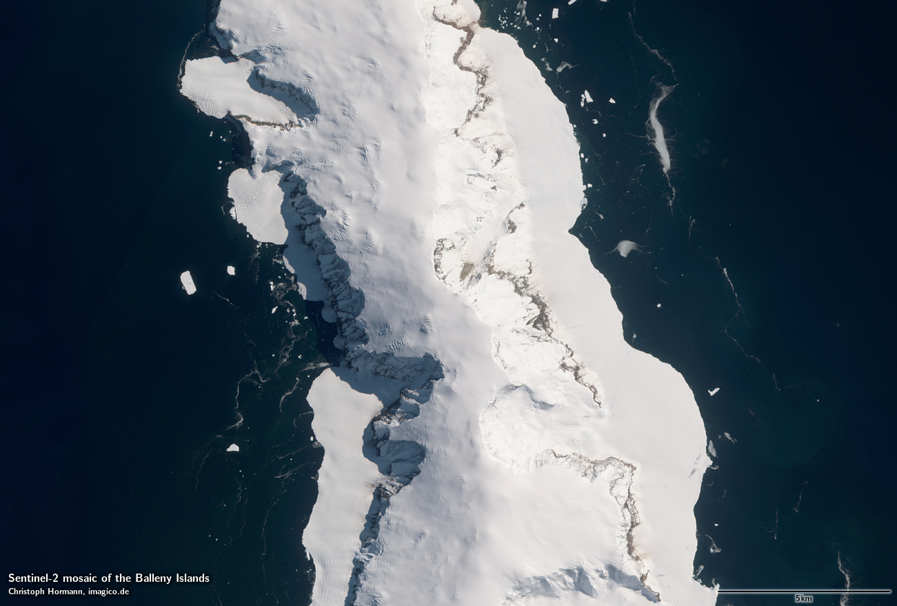
- Visible color mosaic of Balleny Islands
- 10m base resolution, total size 15000×18000 pixel
- Based primarily on Sentinel-2 imagery from 2016-2018, <10 percent from Landsat 8 2013-2018.
- Shows atmosphere compensated surface color, available either as linear surface reflectance values or tone mapped for direct display
- Assembled in UTM zone 58, can be made available in other projections.
Sample gallery
If you are interested in using this Sentinel-2 mosaic use the form below to describe your needs and i will get back to you.
Sentinel-2 mosaic of the Balleny Islands license inquiry
Blog news:
Holding the line – non-locality in map rendering part 2 (06 Jun 2026)
Putting animals on the map (24 May 2026)
Update #2 on FOSSGIS membership fees. (22 May 2026)
Follow-up on FOSSGIS (01 May 2026)
Todays featured image:
Novaya Zemlya and the Matochkin Strait from south
View of the island of Novaya Zemlya from south with the Matochkin Strait in the middle [more]
The most important sections:
Design and Content Copyright 2025 by Christoph Hormann
last updated Fri, 23 May 2025 11:06