Imagico.de

Geovisualizations
by Christoph Hormann
login english deutsch

The Musaicum South Atlantic Islands

The Musaicum South Atlantic Islands satellite image mosaic - South GeorgiaThe Musaicum South Atlantic Islands satellite image mosaic - Falkland Islands
The Musaicum South Atlantic Islands satellite image mosaic - South Sandwich Islands
The Musaicum South Atlantic Islands satellite image mosaic - Saint Helena
The Musaicum South Atlantic Islands satellite image mosaic - Ascension
The Musaicum South Atlantic Islands satellite image mosaic - Tristan da Cunha
The Musaicum South Atlantic Islands satellite image mosaic - Gough Island

The Musaicum South Atlantic Islands is a regional visible color satellite image mosaic of remote Islands of the South Atlantic Ocean - Saint Helena, Ascension, Tristan da Cunha, the Falkland Islands, South Georgia and the South Sandwich Islands - with a ground resolution of 10m. It combines recent Sentinel-2 satellite imagery into the highest quality and most cloud free depiction of the region in this resolution class available today.

It is generated using a classical mosaicing process derived from the methods and techniques developed for local mosaics but with a high degree of automatization. This eliminates most of the time intensive manual steps while maintaining high quality standards.

Compared to the Green Marble the Musaicum South Atlantic Islands offers much higher spatial resolution (10m compared to 250/300m) at the cost of slightly more heterogeneous coloring due to the smaller data basis. Cloud occurrence is comparable to my hand produced local mosaics with less than about one in 100k pixels significantly affected by clouds.

Compared to the Musaicum EU-Plus and the Musaicum West Asia this mosaic is based on improved aggregation techniques with in particular better color calibration and uniformity.

Primary data source for the image is Sentinel-2 imagery from 2020 to 2025 for Saint Helena, Ascension and Tristan da Cunha, 2018-2025 for South Georgia and the South Sandwich Islands and 2021 to 2025 for the Falkland Islands.

Key properties

  • Visible color mosaic of Saint Helena, Ascension, Tristan da Cunha, the Falkland Islands, South Georgia and the South Sandwich Islands
  • 10m base resolution
  • Based on Sentinel-2 data from 2018 to 2025
  • Includes full coverage of lakes and coastal waters, no coverage of the open ocean
  • Shows atmosphere compensated surface color, available either as linear surface reflectance values or tone mapped for direct display
  • Available with illumination as recorded and with shading compensation

Product packaging

The mosaic is produced in different projections for different parts of the coverage area and is assembled in the target projection on demand. The previews of the different parts shown here are in UTM projections. For use in web maps in Mercator projection by default a z14 grid (9.5546m nominal resolution) is provided.

The standard form of distribution of this mosaic is with an alpha channel for seamless blending with a background image for the open ocean - like the Green Marble. This is illustrated in the samples below. Other variants can be produced on request.

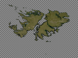
The Musaicum South Atlantic Islands satellite image mosaic - Falkland Islands with transparent oceans and alpha channel for seamless blending The Musaicum South Atlantic Islands satellite image mosaic - Falkland Islands blended with Green Marble based Ocean coloring The Musaicum South Atlantic Islands satellite image mosaic - South Georgia with transparent oceans and alpha channel for seamless blending The Musaicum South Atlantic Islands satellite image mosaic - South Georgia blended with Green Marble based Ocean coloring The Musaicum South Atlantic Islands satellite image mosaic with transparent oceans and alpha channel for seamless blending (detail) The Musaicum South Atlantic Islands satellite image mosaic blended with Green Marble based Ocean coloring (detail)

Product options

In addition to the mosaic with illumination as recorded - which is the recommended version for direct visual applications - this mosaic is also available in a shading compensated version where the differences in illumination due to the topography and shadows cast by mountains are compensated for. This version can be used for example in applications where a synthetic illumination is used to generate a custom shading effect.

Supplementary to the visual color mosaic a vegetation data set is available with the same coverage and source data, documenting the fractional herbaceous and woody vegetation as well as fractional water cover for every 10m pixel.

The Musaicum South Atlantic Islands satellite image mosaic detail with shading as recorded The Musaicum South Atlantic Islands satellite image mosaic detail with shading compensation The Musaicum South Atlantic Islands satellite image mosaic vegetation map visualization The Musaicum South Atlantic Islands satellite image mosaic vegetation map visualization

Sample gallery

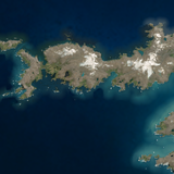
Musaicum South Atlantic Islands sample: Annenkov Island, South Georgia Musaicum South Atlantic Islands sample: Prince Olav Bay, South Georgia Musaicum South Atlantic Islands sample: South Coast, South Georgia Musaicum South Atlantic Islands sample: Stanley, Falkland Islands Musaicum South Atlantic Islands sample: Beaches on the Falkland Islands Musaicum South Atlantic Islands sample: Jason Islands, Falkland Islands Musaicum South Atlantic Islands sample: Fox Bay, Falkland Islands Musaicum South Atlantic Islands sample: Candlemas Islands, South Sandwich Islands Musaicum South Atlantic Islands sample: Edinburgh of the Seven Seas, Tristan da Cunha

Musaicum South Atlantic Islands license inquiry

You can use this form to make your inquiry, it is also available via encrypted connection. If you prefer you can also make your inquiry via email of course, at your option also with encryption).

human verification Please enter the code you can see in the image on the left to verify you are a human and not a spamming script.
* * Required field
Information about you
*
*
*
*
*
*
*
Information about you
Providing more detail on you up front can expedite the ordering process.
*
*
I accept the privacy policy*
What you are interested in

Tone mapped image mosaic with default tone mapping and alpha channel for seamless ocean blending
Mosaic with shading compensation
Linear surface reflectance data for custom processing
Vegetation map

Needed projection:
Required resolution:
Your Musaicum South Atlantic Islands license inquiry

Please add any further details concerning your inquiry here:

Todays featured image:

The Jordan Valley from south
View of the Jordan Valley from south with the northern part of the Sinai Peninsula in the foreground and the north end of the Gulf of Aqaba and the... [more]
Design and Content Copyright 2025 by Christoph Hormann
last updated Thu, 10 Jul 2025 13:30