Imagico.de
Landsat mosaic of Svalbard

The product described on this page has been superseded by the Musaicum European Arctic Islands.
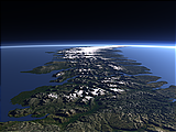
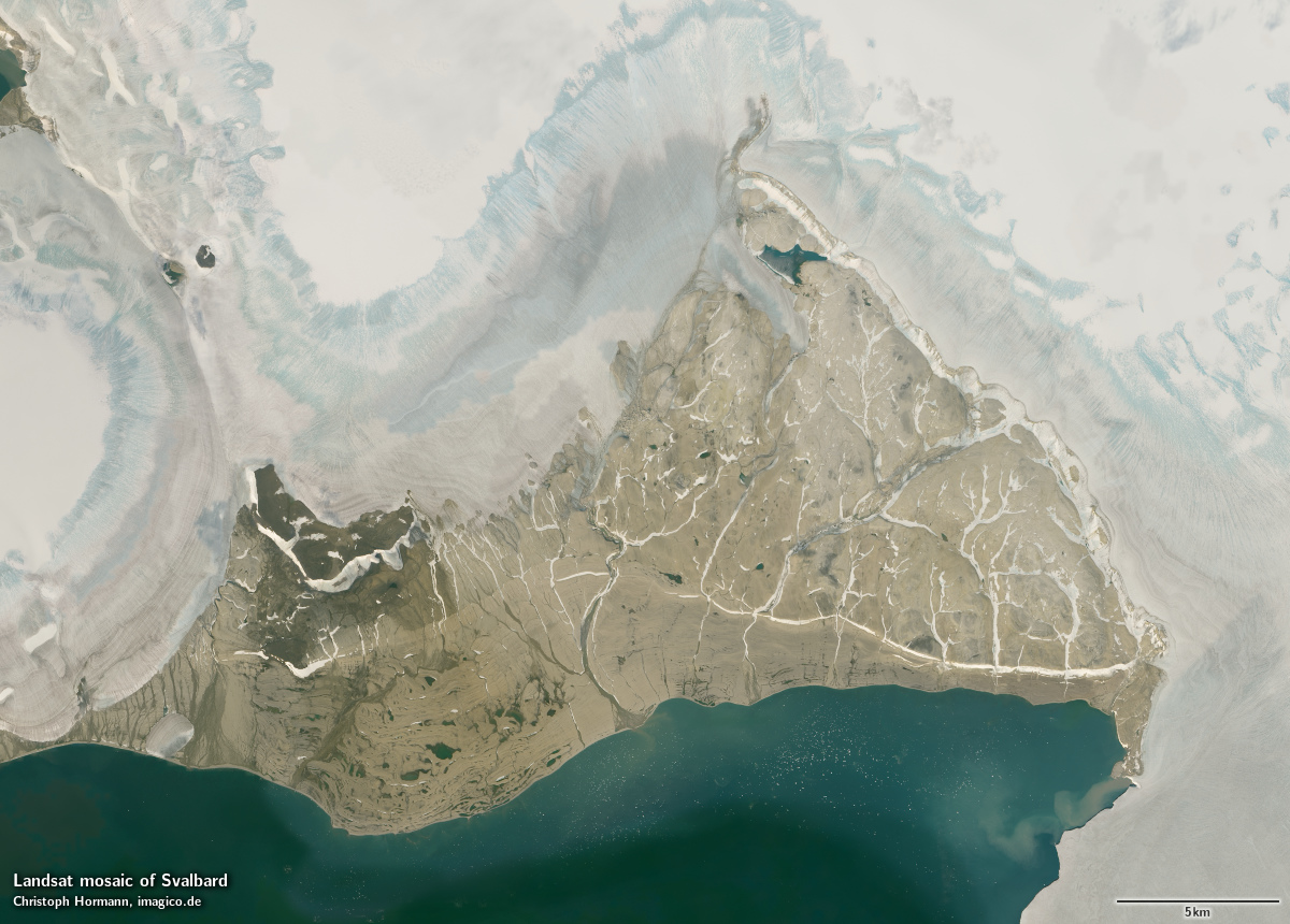
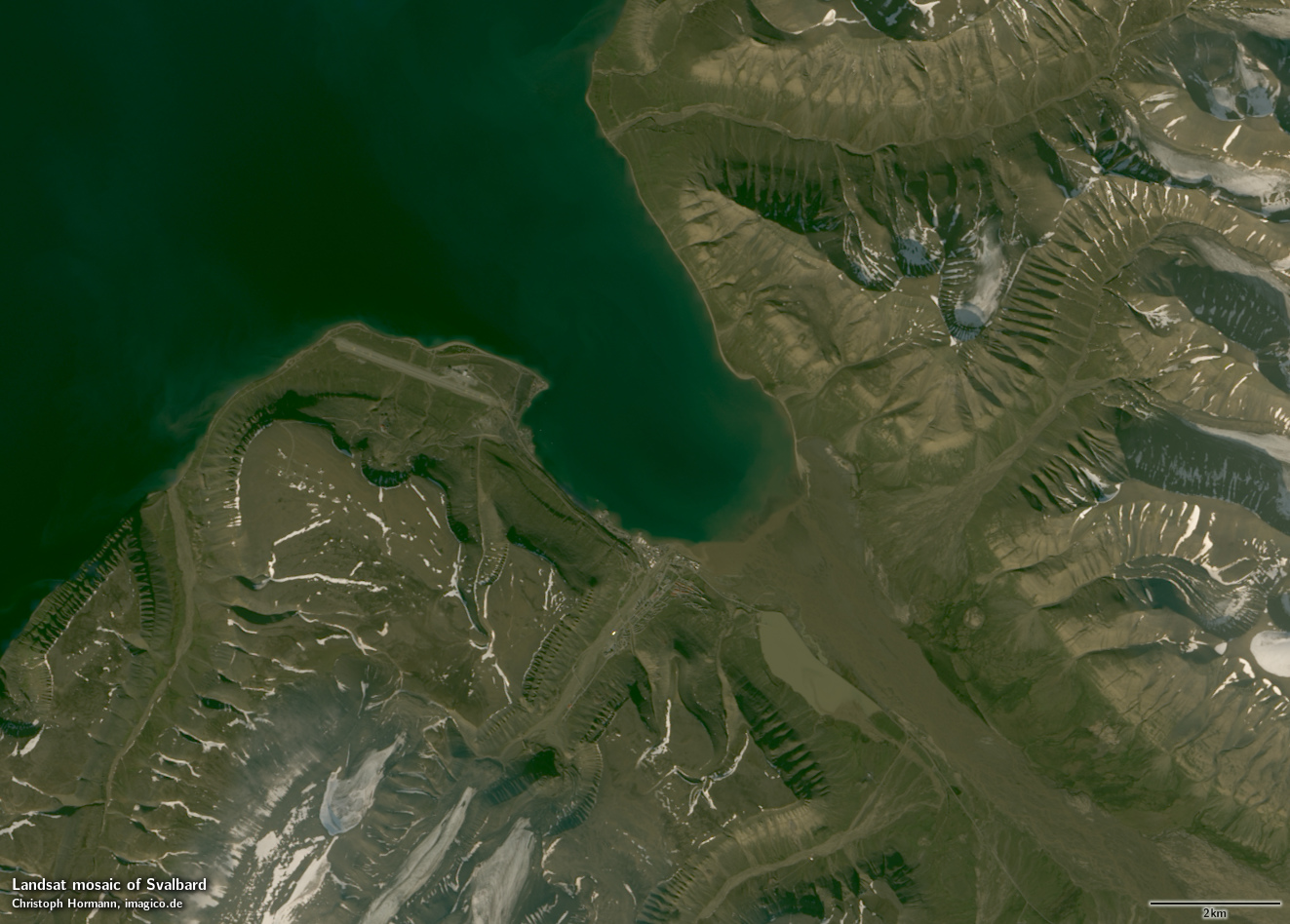
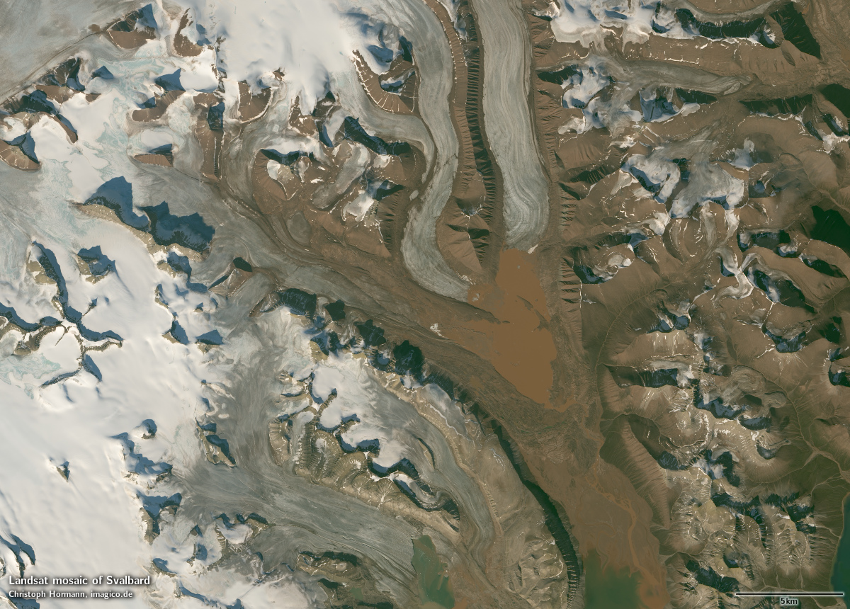
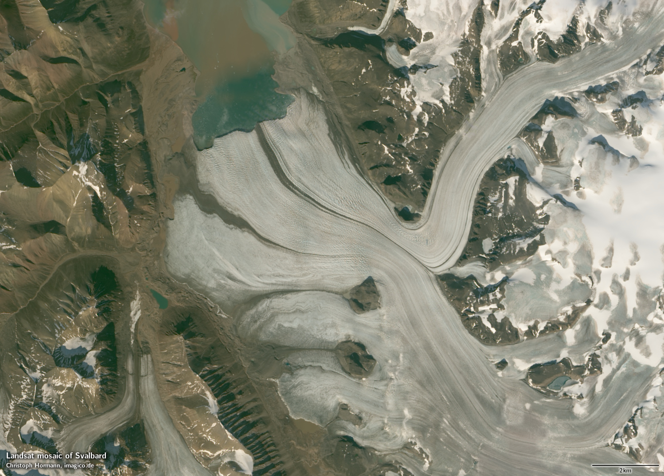
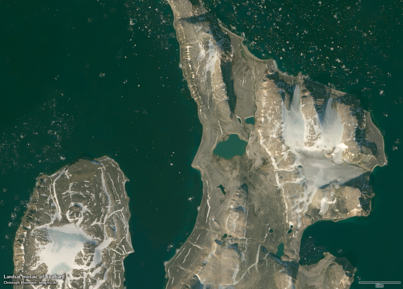
This Landsat mosaic of Svalbard gives an up-to-date visual color impression of the archipelago of Svalbard. For this I processed and assembled Landsat images for the area covering the islands of Spitzbergen, Nordaustlandet, Kvitøya, Edgeøya and Hopen as well as numerous smaller islands around.
This Landsat mosaic can be considered a higher resolution supplement to the Green Marble and similarly it represents the surface color with compensation for the effects of the atmosphere. Selection of source data is targeting a late summer time frame with priority on August.
The mosaic features seamless coverage of the ocean using the Green Marble mosaic for areas further from the coast without Landsat coverage.
Source data is almost exclusively Landsat 8 imagery from 2013 to 2015 with only very few small areas where this has been supplemented by Landsat 7 imagery from 2011-2013.
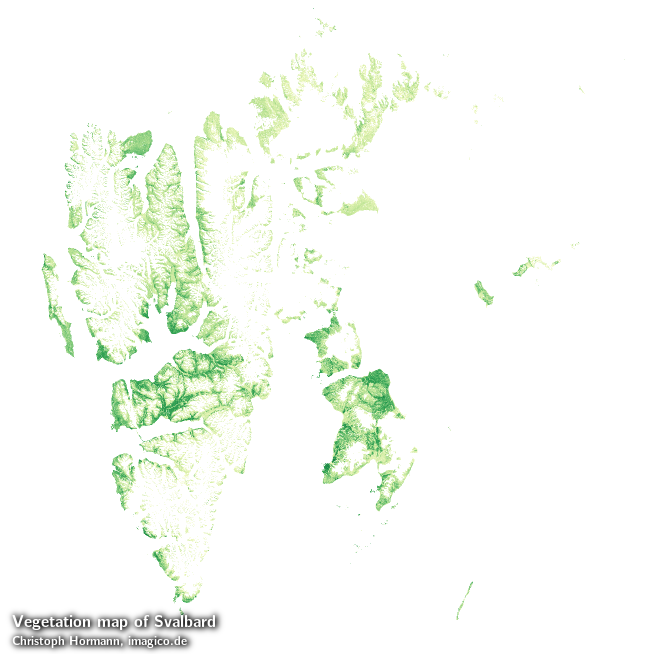
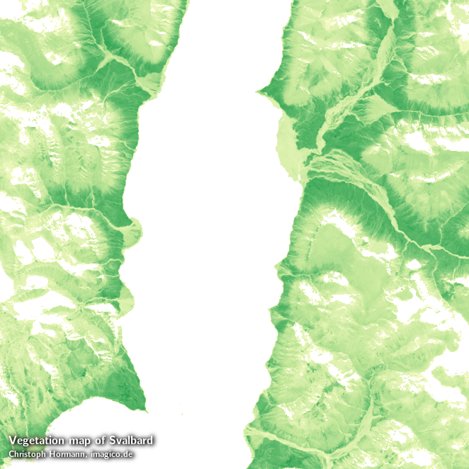
In addition to the visual color mosaic there is also a vegetation data set available based on the same Landsat imagery in 30m resolution depicting the maximum amount of vegetation at every point.
Key properties
- Visible color mosaic of Svalbard (excluding Bjørnøya)
- 15m base resolution, total size 35000x35000 pixel (vegetation map: 30m)
- Based on Landsat imagery, primarily Landsat 8 from 2013-2015, <1 percent from Landsat 7 2011-2013
- Ocean color based on Green Marble
- Shows atmosphere compensated surface color, available either as linear surface reflectance values or tone mapped for direct display
- Assembled in UTM zone 34, processed using proj4 +etmerc algorithms for improved accuracy far away from the central meridian, can be made available in other projections.
Sample gallery

If you are interested in using this Landsat mosaic use the form below to describe your needs and i will get back to you.
Landsat mosaic of Svalbard license inquiry
Blog news:
Todays featured image: