Imagico.de
Geovisualizations
by Christoph Hormann
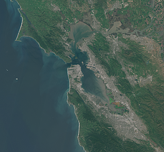
Spring in San Fancisco
View information
The San Fancisco Bay area in April 2016. Image is based on Copernicus Sentinel data from 2016, attribution required.
| view data | |
|---|---|
| Location: | 122.4° W, 37.75° N |
| Altitude: | 786 km |
| View Direction: | 0° |
| Camera Angle: | 0° |
| Available size: | up to 14000×13000 pixel |
Catalog inquiry - LicensePrint
Blog news:
More Atlantic Islands imagery (10 Jul 2025)
The OpenStreetMap summer storm (22 Jun 2025)
Maritime farming – displaying aquacultures (03 Jun 2025)
Todays featured image:

Whole earth in July with sea ice and clouds (Europe)
Whole earth view in northern hemisphere summer with sea ice and clouds, focusing on Europe with the Middle East and North Africa prominently visible. [more]
The most important sections:
Design and Content Copyright 2025 by Christoph Hormann
last updated Sat, 24 May 2025 15:24
