Imagico.de
Geovisualizations
by Christoph Hormann
Eastern Spitzbergen
View information

View of the eastern coast of the island Spitzbergen in Svalbard with the Storfjorden on the bottom right and the strongly glaciated Olav-V-Land and the Hinlopenstretet behind separating Spitzbergen from Nordaustlandet on the far right. Uses data from the Norwegian Polar Institute (CC-By 4.0).
| view data | |
|---|---|
| Location: | 19.881° E, 76.805° N |
| Altitude: | 51.863 km |
| View Direction: | 345° |
| Camera Angle: | 46° |
| Available size: | up to 8000×6000 pixel |
Catalog inquiry - LicensePrint
Blog news:
Mapping of populated places in OpenStreetMap (28 Jun 2026)
FOSSGIS Membership Dues – The End of the Story (23 Jun 2026)
FOSSGIS membership fees – Update #3 (18 Jun 2026)
Holding the line – non-locality in map rendering part 2 (06 Jun 2026)
Todays featured image:
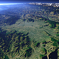
The Kathmandu Valley
This view shows the Valley of Nepal's capital Kathmandu at the foot of the Himalaya mountain range visible in the background. [more]
The most important sections:
Design and Content Copyright 2026 by Christoph Hormann
last updated Thu, 09 Apr 2026 12:56