Imagico.de
Geovisualizations
by Christoph Hormann


The Norwegian coast south of Hammerfest
View information
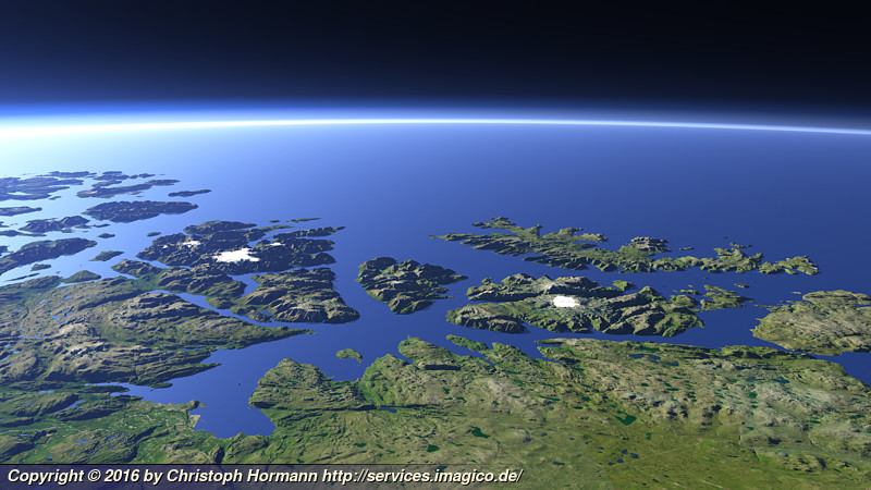
View of the northern Norway coast south of the town of Hammerfest with the Altafjord on the foreground left and the islands Sørøya, Seiland and Stjernøya. Uses data copyright OpenStreetMap contributors and elevation data from Kartverket (CC-By 4.0).
| view data | |
|---|---|
| Location: | 24.975° E, 69.823° N |
| Altitude: | 31.863 km |
| View Direction: | 302° |
| Camera Angle: | 60° |
| Available size: | up to 6400×3600 pixel |
Catalog inquiry - LicensePrint
Blog news:
Mapping of populated places in OpenStreetMap (28 Jun 2026)
FOSSGIS Membership Dues – The End of the Story (23 Jun 2026)
FOSSGIS membership fees – Update #3 (18 Jun 2026)
Holding the line – non-locality in map rendering part 2 (06 Jun 2026)
Todays featured image:
The Norwegian coast south of Hammerfest
View of the northern Norway coast south of the town of Hammerfest with the Altafjord on the foreground left and the islands Sørøya, Seiland and... [more]
The most important sections:

Design and Content Copyright 2026 by Christoph Hormann
last updated Thu, 09 Apr 2026 12:56