Imagico.de
Geovisualizations
by Christoph Hormann


Kashgar and the Kongur Shan
View information
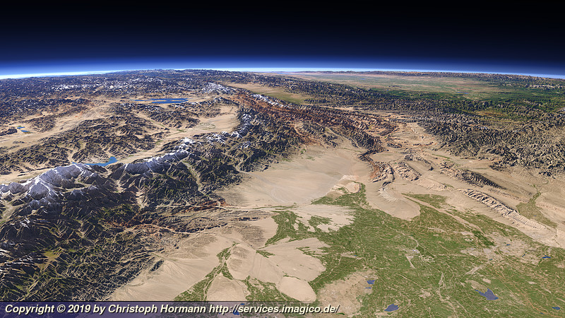
View westward from Kashgar in the foreground right with the Kongur Shan mountains on the left towards the Tajikistan and Kyrgyzstan border with the Pamir on the background left and the Fergana Valley on the far right.
| view data | |
|---|---|
| Location: | 77.145° E, 38.729° N |
| Altitude: | 51.863 km |
| View Direction: | 286.5° |
| Camera Angle: | 50° |
| Available size: | up to 9600×5400 pixel |
Catalog inquiry - LicensePrint
Blog news:
The OSMF board elections 2026 (25 Sep 2026)
Communication is hard (24 Sep 2026)
State of the Map 2026 impressions (02 Sep 2026)
State of the Map talk and poster (24 Aug 2026)
Todays featured image:

Summer evening view of northern Norway around Tromsø
Landsat 8 evening image of the coast of northern Norway around Tromsø. [more]
The most important sections:

Design and Content Copyright 2026 by Christoph Hormann
last updated Thu, 09 Apr 2026 12:56