Imagico.de
Geovisualizations
by Christoph Hormann


Southern New Zealand
View information
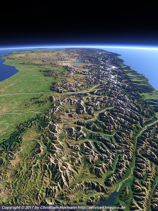
View of the southern part of the south Island of New Zealand with the Southern Alps on the right side. Uses data copyright OpenStreetMap contributors and elevation data from LINZ (CC BY 3.0 NZ).
| view data | |
|---|---|
| Location: | 172.588° E, 42.581° S |
| Altitude: | 51.863 km |
| View Direction: | 230° |
| Camera Angle: | 53° |
| Available size: | up to 7200×9600 pixel |
Catalog inquiry - LicensePrint
Blog news:
State of the Map 2026 impressions (02 Sep 2026)
State of the Map talk and poster (24 Aug 2026)
OpenStreetMap, business interests and capitalism (06 Aug 2026)
Group communication is hard (29 Jul 2026)
Todays featured image:
Autumn 2017 in Svalbard
Landsat 8 image of western Svalbard around Isfjorden in early October 2017 [more]
The most important sections:

Design and Content Copyright 2026 by Christoph Hormann
last updated Thu, 09 Apr 2026 12:56