Imagico.de
Geovisualizations
by Christoph Hormann
The South Sandwich Islands in late Winter
View information

Landsat mosaic of the South Sandwich Islands in late winter 2014 including Southern Thule, Bristol, Montagu, Saunders and Candlemas Islands as well as Visokoi Island, the latter mostly covered by clouds. The ocean shows extensive sea ice coverage as well as various icebergs well visible in the low sun.
| view data | |
|---|---|
| Location: | 27° W, 58° S |
| Altitude: | 700 km |
| View Direction: | 0° |
| Camera Angle: | 0° |
| Available size: | up to 13000×22600 pixel |
Catalog inquiry - LicensePrint
Blog news:
Mapping of populated places in OpenStreetMap (28 Jun 2026)
FOSSGIS Membership Dues – The End of the Story (23 Jun 2026)
FOSSGIS membership fees – Update #3 (18 Jun 2026)
Holding the line – non-locality in map rendering part 2 (06 Jun 2026)
Todays featured image:
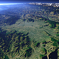
The Kathmandu Valley
This view shows the Valley of Nepal's capital Kathmandu at the foot of the Himalaya mountain range visible in the background. [more]
The most important sections:
Design and Content Copyright 2026 by Christoph Hormann
last updated Thu, 09 Apr 2026 12:56