Imagico.de
Geovisualizations
by Christoph Hormann


The Middle East and the Mediterranean
View information
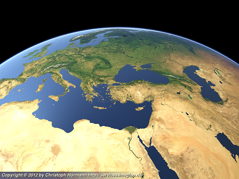
View of the Middle East and the Mediterranean region from Spain in the west up to Iran in the East
| view data | |
|---|---|
| Location: | 29° E, 17.358° N |
| Altitude: | 5629 km |
| View Direction: | 0° |
| Camera Angle: | 40° |
| Available size: | up to 8000×6000 pixel |
Catalog inquiry - LicensePrint
Blog news:
The OSMF board elections 2026 (25 Sep 2026)
Communication is hard (24 Sep 2026)
State of the Map 2026 impressions (02 Sep 2026)
State of the Map talk and poster (24 Aug 2026)
Todays featured image:
Algae bloom off the outer Outer Hebrides
Sentinel-2 image showing algae bloom off the outer Outer Hebrides in Scotland around St. Kilda in Summer 2019. [more]
The most important sections:

Design and Content Copyright 2026 by Christoph Hormann
last updated Thu, 09 Apr 2026 12:56