Imagico.de
Geovisualizations
by Christoph Hormann


Western Europe from southeast
View information
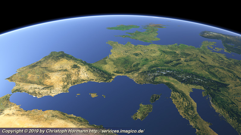
View of Western Europe from the southeast from the Iberian Penisula to Italy and Western Scandinavia. Uses waterbody data copyright OpenStreetMap contributors.
| view data | |
|---|---|
| Location: | 16.138° E, 25.347° N |
| Altitude: | 2821.86 km |
| View Direction: | 328.5° |
| Camera Angle: | 35° |
| Available size: | up to 9600×5400 pixel |
License inquiry
Blog news:
Trends for the future of map design in OpenStreetMap (20 Apr 2024)
The current state of map design in OpenStreetMap (18 Apr 2024)
Digital map design history (16 Apr 2024)
Addresses and Entrances (11 Apr 2024)
Todays featured image:

Whole earth view focusing on East Asia
Whole earth view focusing on East Asia with eastern Russia, China and Indonesia prominently visible [more]
The most important sections:

Design and Content Copyright 2024 by Christoph Hormann
last updated Sat, 30 Mar 2024 23:52